Coastal observation

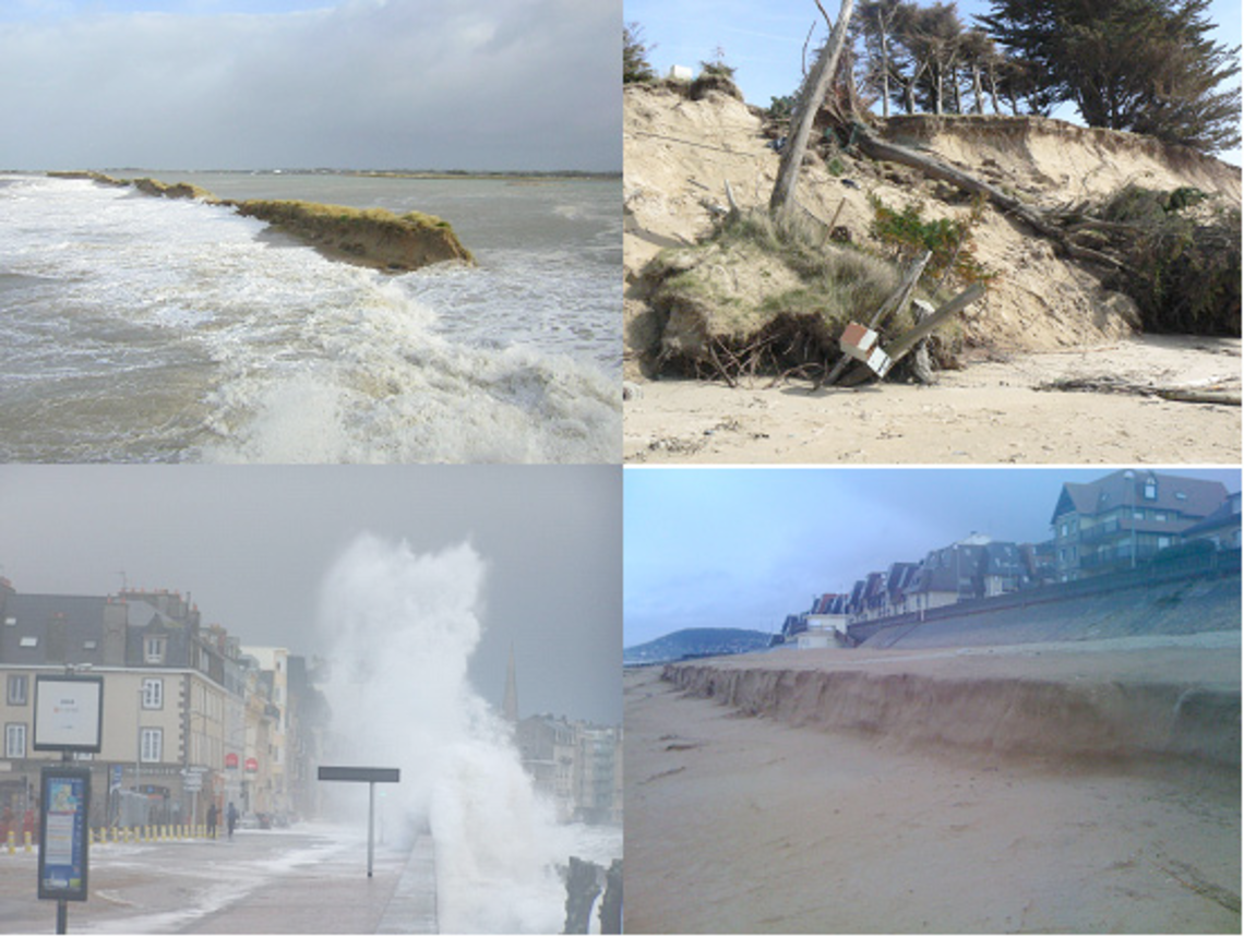
The coastal zone is a vulnerable area and will be subject to major challenges in the coming years, due in particular to climate change (sea level rise, increasingly intense and more frequent storms).

Coastal areas, and particularly the coastline, can evolve rapidly, with areas of erosion of sometimes several meters per year for soft-soil coasts. The increased assaults of the sea during storms amplify the intensity of erosion and can cause submersions in low areas potentially damaging to the local population and economy. Long-term observation of the evolution of this area is therefore a major issue in which the UMR Geo-Ocean, in close collaboration with the Geomer laboratory, is fully involved through the SOERE Observation and Experimental Systems, in the long term, for environmental research «Trait de côte» certified by Allenvi in 2010.

The SOERE “Coastline” is a multi-site, integrated observation network on the three French metropolitan coastal facades. It is managed by the universities of Brest, Caen and Montpellier, in collaboration with regional academic and public partners (General Councils, Regional, Dreal, DDTM, etc.).

  • The objective is to sustain the long-term time series, harmonize the observation strategies between laboratories, implement modern means of measurement for an integrated observation of the evolution of the object «coastline» and fundamental dynamic forcing parameters.

Coastal topography data, transformed into Digital Field Models (DFM), provide basic information for the development of numerical or even physical models in order to undertake prospective research on the fate of coastal systems. The measurements carried out are mainly topographical, bathymetric, sea level measurements carried out with laboratory means:

  • Multi-beam Acoustic Sounders (SMF)
  • Terrestrial Laser Scanner (TLS or Lidar)
  • Topography equipment (differential GPS)
  • Onboard instruments and DRELIO imaging drone

UMR Geo-Ocean is involved in the OBServatory of Water and Erosion in the Antilles (ObsERA), a French CNRS-INSU observation service dedicated to chemical and physical erosion, and their influence on the environment (soil development, river chemistry, etc.) in the specific context of a tropical volcanic island.

Member of the Réseau de Bassins Versants de Recherche and the Critical Zone Observatory Network, this observatory involves teams from the Institut de Physique du Globe de Paris, the Observatoire Volcanologique et Sismologique de Guadeloupe, the Université Antilles-Guyana, the Ocean Geosciences Laboratory (UBO) and the Earth Sciences Laboratory of the Claude Bernard University (Lyon I).

The objective of ObsErA is to build a database of water flows (precipitation and river flows), sediment flows and organic matter (especially carbon). In the rivers and on the slopes as well as in the chemical composition of rivers and soils in the particular context of the island of Basse-Terre in Guadeloupe, marked by a tropical climate and active volcanism. This database will enable the scientific community to study and quantify chemical and physical erosion patterns and their impact on the environment (soil composition, river chemistry, carbon flux, etc.).

To date, ObsErA follows the evolution of 3 watersheds located within the National Park of Guadeloupe: Capesterre, Bras-David and Vieux-Habitants.

UMR Geo-Ocean is involved in the ObServatoIre des RISques Côtiers (OSIRISC), which aims to develop an innovative interdisciplinary monitoring system to promote integrated and more effective coastal risk management by involving local inhabitants, socio-economic actors and local authorities on the Atlantic coast of Brittany.

OSIRISC is one of the five citizen observatories of natural hazards managed by the AGEO project (for the Atlantic GEOhazard Platform). All five observatories of the project are interested in rare phenomena with potentially significant impacts on urbanized coastal territories (marine submersion, coastal erosion, falling blocks, flooding, earthquake, etc.).

OSIRISC focuses on the observation of the vulnerability of coastal risks of erosion and submersion in Brittany

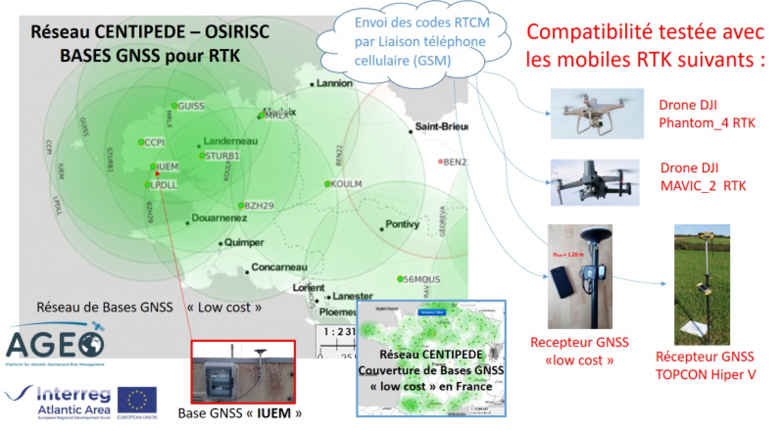
The GNSS backbone network for the coast of Western Brittany (figure opposite) is based on the CENTIPEDE project, which aims to create a network of open and available RTK bases for anyone in the coverage area (~50 km).